Monthly Archives: December 2015

Ski descent from Mount Si haystack

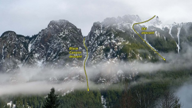
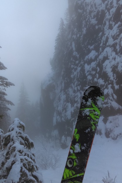
The end of 2015 saw two notable ski feats on Mount Si; one a descent from the top of haystack and the other down the Black Canyon. Both were made possible by unusually heavy snow fall that was stable enough to ski on without triggering slides.

Mount Si from Rachor Place NE

Mount Si from Rachor Place NE


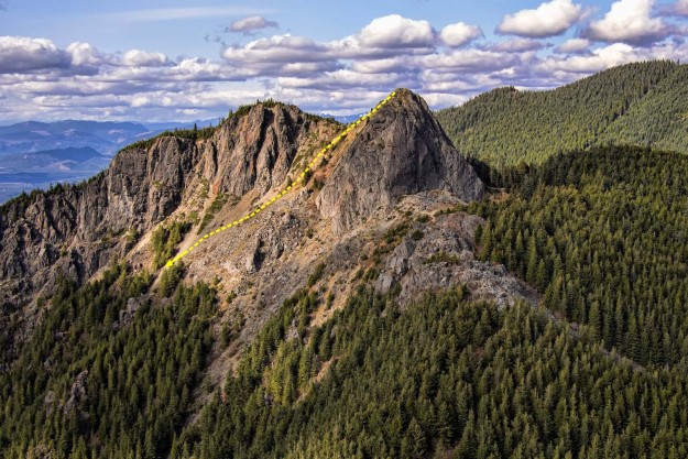
Peter Avolio, Trevor Kostanich and Dave Jordan accomplished a rare ski descent of Mount Si starting from the top of the haystack. Previous descents have been done down the open gullies of the west face. However, this is probably not the first ski descent from the top because other skiers report that it was done in the early 2000s and earlier.

Dave Jordan skis from the top of the Haystack on the summit of Mount Si. Trevor Kostanich is visible to the right of Jordan. Photo by Emily Larson


20150422HaystackFromHangGlider

The Mount Si haystack as seen from a paraglider with the skier’s approximate route shown. Photo by Aaron Hinkley.


Trevor Kostanich (left) and Dave Jordan prepare to ski from the top of Mount Si’s summit block. Photo by Peter Avolio.


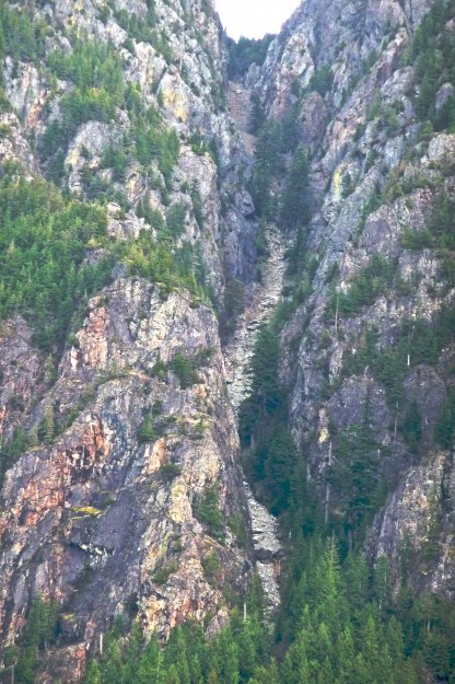
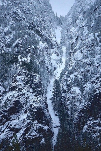
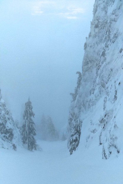
A few days earlier Frank Bush also took advantage of the unusual snow conditions and reported skiing down the Black Canyon. In his words “On Christmas morning Mt Si was ripe, but couldn’t find a partner so I solo skied the deep walled canyon with a 12 foot rock step 2/3 down. Side step down steep rock slab with shrubs to grab (60′) to get into it, then several hundred feet of good pow turns before jump turns on 10″ covered rocks. Rock step near bottom is very obvious, it crosses the whole line from wall to wall.

20100214BlackCanyon

The Black Canyon in February, 2010. A difficult scramble route.

20151224BlackCanyon

The Black Canyon in December, 2015. An even more difficult ski line. Photo by Frank Bush.


20151224BlackCanyonSki1

Black Canyon ski descent. Photo by Frank Bush.

20151224BlackCanyonSki2

Black Canyon ski descent. Photo by Frank Bush.


Related News

Fall storms block trails

Three severe fall storms have been devastating to some of the Middle Fork trails. This update summarizes what is known as of January 12, 2016. Updates will be added as news trickles in.

Little Si
No reports of problems in recent trip reports

Mount Si
A hiker on the day of the most recent storm reported no serious blowdown

Teneriffe Falls / Peak
On the WTA site Stuke Sowle posted a January 8 grand tour trip report including Teneriffe falls and peak, the CCC plateau, Mailbox Peak, and Granite Creek trail.

Mailbox Peak
About two dozen trees are down across the new trail, but deep snow obscures the trail higher up. There are no reported trees down on the old trail. The DNR has cleared trees blocking access to the parking lot. Some recent storms have left slippery snow on the access road to the parking lot so on those days the gate is left locked to prevent cars from sliding down the relatively steep slope.

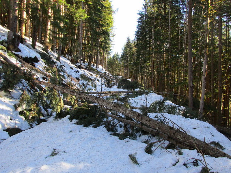
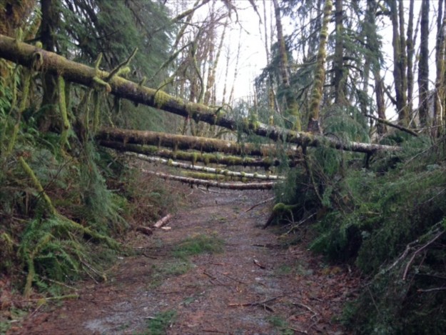
Granite Creek – This trail has a large number of trees down and is impassible beyond the Granite Creek bridge. As of December 26 a trail has been broken in deep snow as far as the bridge.
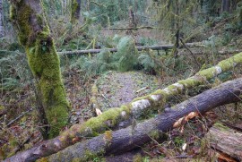
Granite Creek blowdown near the trailhead

Granite Creek blowdown near the trailhead

Blowdown on the Granite Creek trail beyond the bridge. Photo by Kevin Smythe

Blowdown on the Granite Creek trail beyond the bridge. Photo by Kevin Smythe


December 7 seekingultra report: Granite Lakes trail windstorm destruction“The Granite Lakes trail off of the Middle Fork Snoqualmie road has been obliterated by blowdown after the bridge crossing Granite Creek. There are 100+ blowdowns in the 1/4-mile past the bridge and the 100 yards ahead we could see when we stopped appeared to be more of the same.

December 19 WTA report: Thompson Lake, Granite Lakes Trail“After the second bridge is when the trail starts to become difficult to navigate. We went up and over fallen trees for about 30-40 minutes with NO relief and none that looked like it was coming. Ultimately it became too much and a little unsafe for the dogs to navigate.”
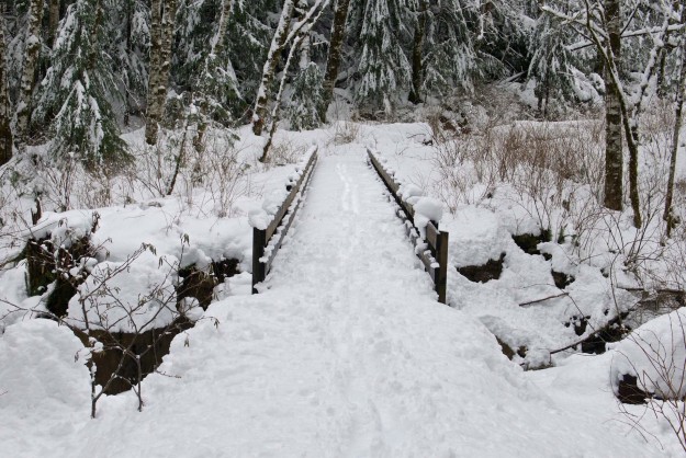
Deep snow on the Granite Creek bridge

Deep snow on the Granite Creek bridge


Sitka Spruce – Minor blowdown but still passable. The log over the small creek near the concrete bridge is partially washed out. Whitebark@nwhikers.net reports that he cleared some of the blowdown on December 29.
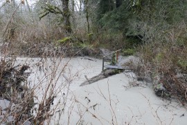
Partially washed out Sitka Spruce creek bridge
Partially washed out Sitka Spruce creek bridge

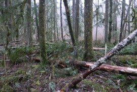
Blowdown on the Sitka Spruce trail

Blowdown on the Sitka Spruce trail


Pratt River – There are 27 trees down in the first .6 miles to the Rainy Creek bridge and it is very difficult to get past some of them because of steep slopes below the trail. The root ball of two trees pulled up part of the trail about 1/4 mile in but it is still easily passed.
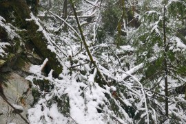
Pratt River trail blowdown
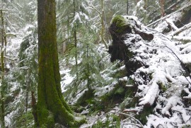
Pratt River trail blowdown

Pratt River trail blowdown
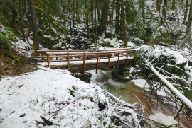
Pratt River trail blowdown

Pratt River trail blowdown

Pratt River trail blowdown

Rainy Creek bridge. A big tree just missed it on the far side

Rainy Creek bridge. A big tree just missed it on the far side


CCC – No recent reports. Status is unknown.


Bessemer Roadoneeyedfatman@nwhikers.net posted a Bessemer Road trip report from January 9, 2016. The Middle Fork road was icy and difficult to drive, there was some tedious blowdown on the Bessemer Road. He turned around at ~2900′.

Tedious blowdown on the Bessemer Road. Photo by peaklist@flickr


Middle Fork – There are three trees down in the first mile, two of these are difficult to cross. Beyond that is unknown but probably bad. The winds were severe in this part of the valley based on the number of trees down across the road on the other side of the river.
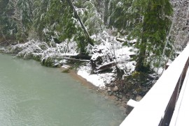
Recently fallen trees by the Gateway bridge
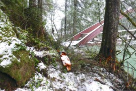
Recently fallen trees by the Gateway bridge

Blowdown on far side of Gateway bridge
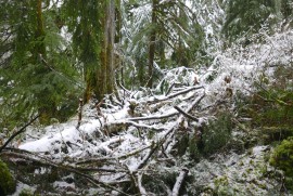
Blowdown on far side of Gateway bridge

Middle Fork trail blowdown
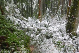
Middle Fork trail blowdown
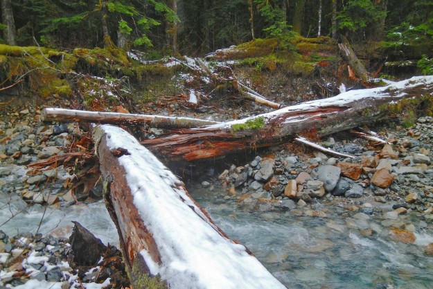
Middle Fork trail blowdown

Middle Fork trail blowdown

20151215BurntbootBridge

Damaged, but still usable log bridge over Burntboot Creek near Goldmyer Hot Springs. The December storm undercut the support on the far side and lowered the two big logs so they are no longer roughly level as before. The closer log has also been rotated so the flattened part no longer points up. Photo by Bill Davis.


Dingford Creek – No recent reports. Status is unknown but this part of the valley did not experience the worst winds and the trail is probably buried under snow for the winter season after the heavy snows of the Christmas week.

Taylor River The last quarter mile to the trailhead has been washed out. Park at the wide spot just past the first Taylor River bridge. The trail was apparently not hit too hard. On 12/19/2015 PataGenn at WTA reported “Snow started before the MF trailhead. 3-4″ of snow at the beginning, 7-8″ when we turned around at about 3 3/4 miles. Snow falling from the trees as it warmed up.” Photo by PataGenn.


Dutch Miller Gap – No recent reports. Status is unknown but this trail is probably buried under snow for the winter season after the heavy snows of Christmas week.

Work begins on Granite Creek shortcut trail

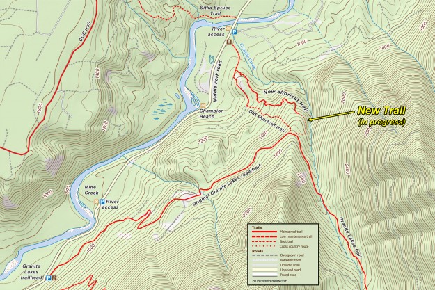
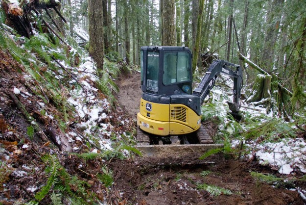
Work has begun on the new Granite Creek shortcut trail. This trail will start at a new parking lot the DNR plans to build near the concrete bridge and will wind up the ridge west of Granite Creek to join the old road, recently converted to a trail. The new trail starts out on an old logging road but leaves about 1/3 miles in on a new track that stays along the ridge line. For a number of years there has been a little know user-built trail that some hikers have used to shorten the distance to Granite Lakes by about 1 1/2 miles each way. Sections of that trail have always been steep and muddy and the new trail looks like it will be a big improvement when completed. But as of December 26 with recent rains and snow, the new trail is also very muddy and slippery and does not yet connect with the main trail above.

New Granite Creek shortcut trail route. The trail is still being roughed in. The dotted line is based on pink flagging indicating where the rest of the trail will probably be located.

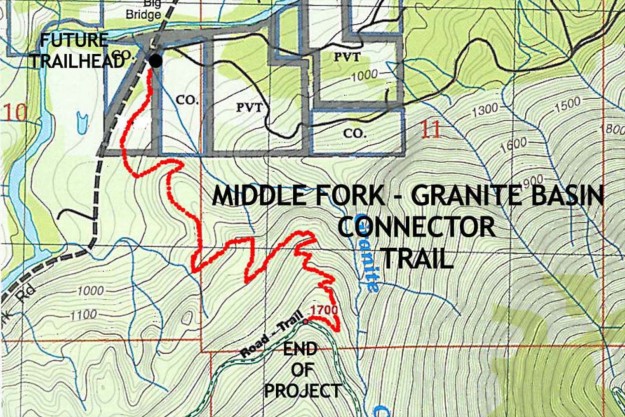
In a 2009 planning document the DNR said “The new trail will follow the old logging road for half a mile, but then leave the road and wind its way up to the east amongst the various stream drainages west of the Granite Creek Canyon. Once above these deeply cut drainages, the trail will climb the dry ground available west of Granite Creek to meet the Granite Road-Trail, utilizing as few climbing turns and switchbacks as possible.”
2009PlanningMap

2009 trail route concept. Planning has been going on for a long time. The route as constructed deviates quite a bit from this early version.

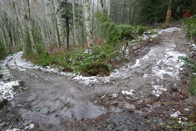
The new trail currently leaves the old logging road about .3 miles from the main road

The new trail currently leaves the old logging road about .3 miles from the main road

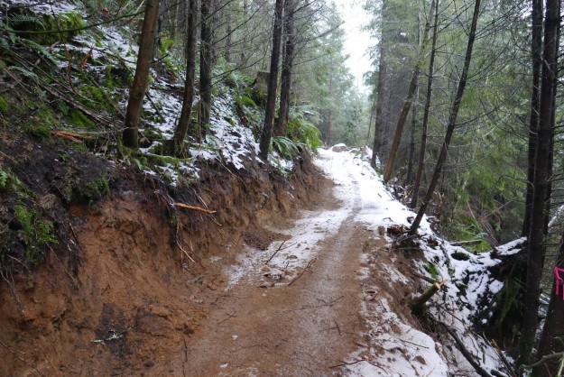
The new trail is roughed in with freshly cut banks for now

The new trail is roughed in with freshly cut banks for now

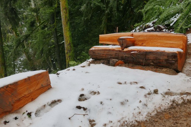
Amenities are already being built such as this bench at a spot with a view over Granite Creek

Amenities are already being built such as this bench at a spot with a view over Granite Creek

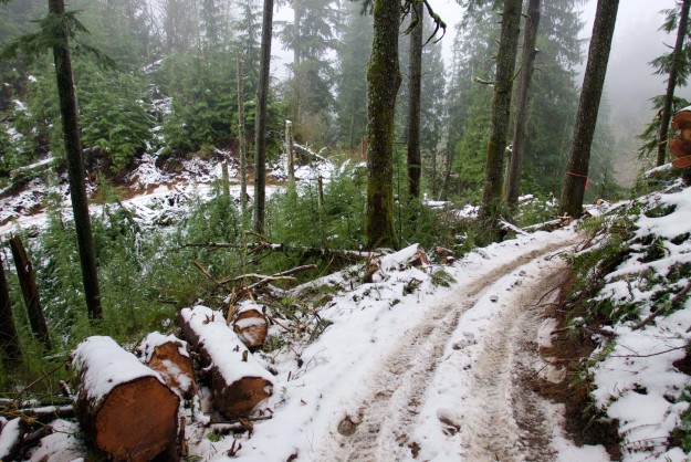
The new trail winds back and forth on a ridge and stays much closer to Granite Creek than the old user-built shortcut trail

The new trail winds back and forth on a ridge and stays much closer to Granite Creek than the old user-built shortcut trail

Excavator that's handling the initial trail rough-in

Excavator that’s handling the initial trail rough-in

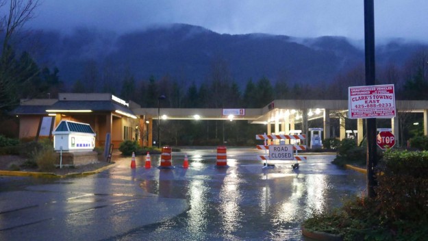
December storm extends road closure

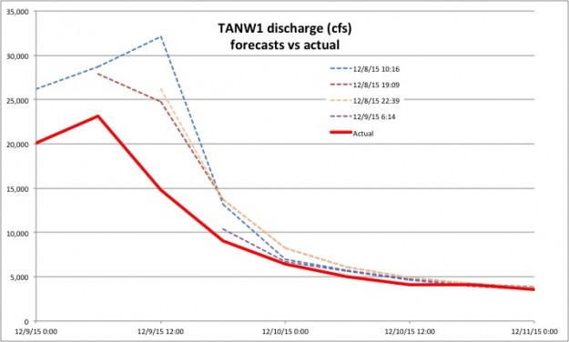
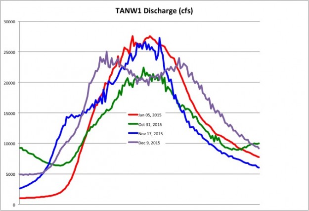
Just as the Middle Fork road was about to be opened for the winter season another major storm blew through resulting in yet another extension of the closure. Four inches of warm rain was recorded at Valley Camp for December 8 with an additional 1.22 inches the following day. The TANW1 gage showed a double peak, first at 25,000 cfs at 6pm on December 8 and 24,000 cfs at 5:15am on December 9.

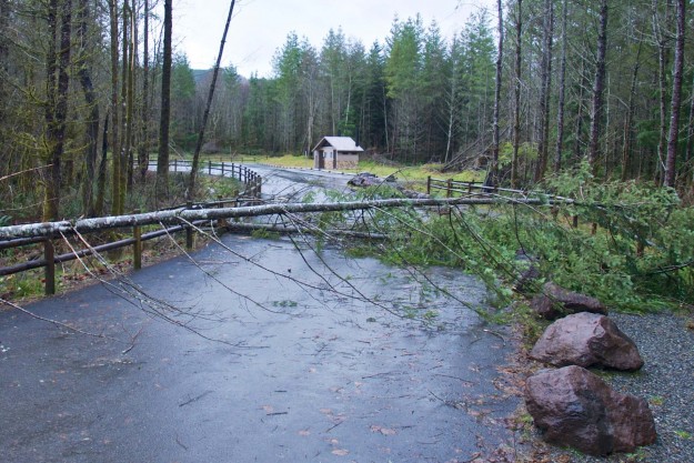
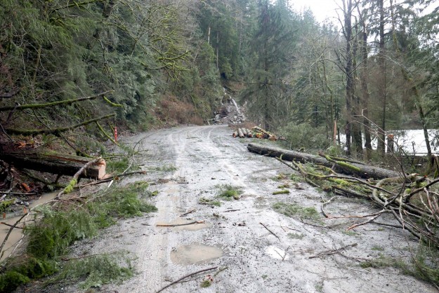
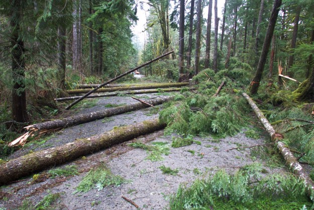
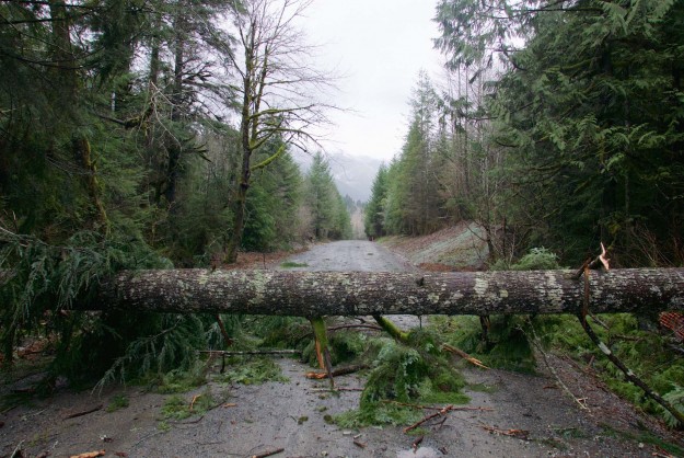
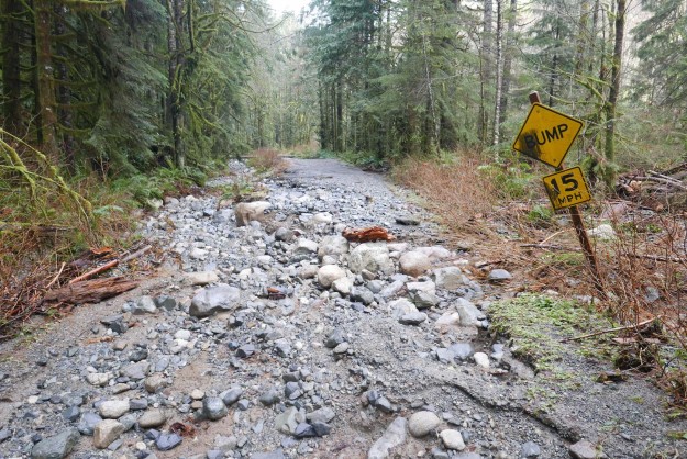
After seeing the effects, the road closure was justified as wind gusts blew down numerous trees, mostly in the first two miles of the road above the Mailbox trailhead. About seven medium sized trees blocked the road to the Dingford trailhead and these were cleared by Friday. Reports continue to come in of blowdowns on trails, but the full impact of this series of severe winter storms may not be known until spring.

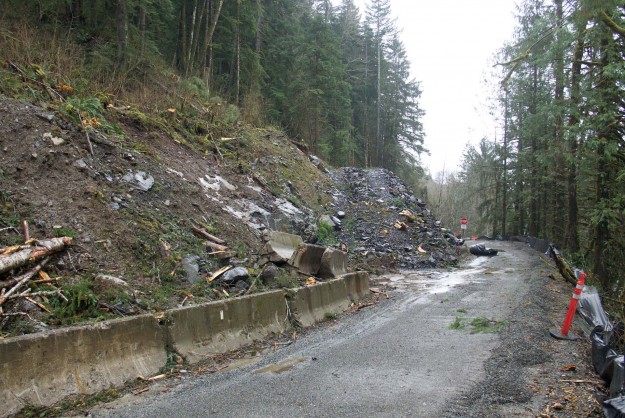
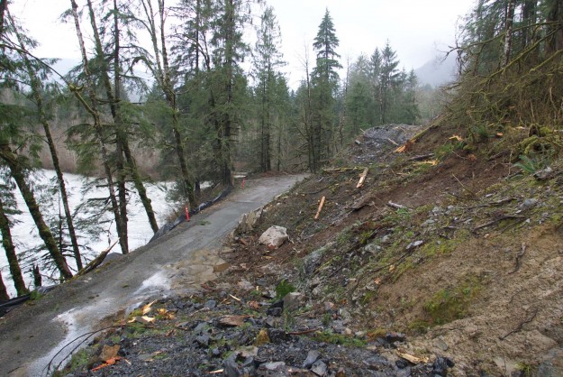
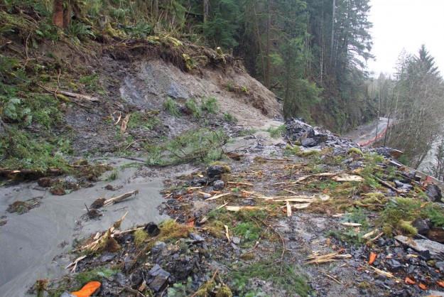
After the storm on Wednesday, December 9, a geotechnical engineer inspected the slope and Champion beach and approved opening the roadway through the slide area. There is barrier in place to catch any debris that may come down. ACI is clearing the downed trees through the project area and the road may be open to the public as early as Thurday, December 17.

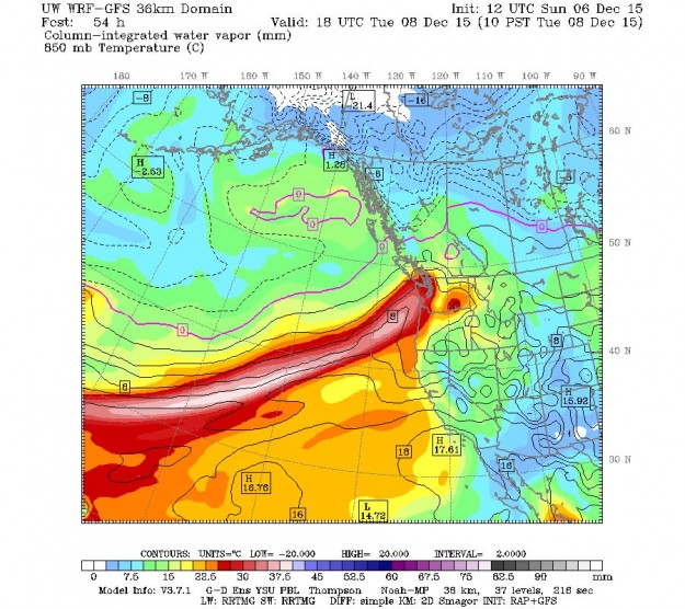
Atmospheric River from Cliff Mass weather blog

Atmospheric River from Cliff Mass weather blog

TANW1 Discharge

Early forecasts for this storm predicted a very dangerous crest of up to 32,100 cfs. Fortunately that did not occur or else much more damage would have been done.

Early forecasts for this storm predicted a very high crest of up to 32,100 cfs. Fortunately that did not occur or else much more damage would have been done.

Comparison of the four major storms so far in 2015. The most recent storm didn't crest quite as high but lasted longer

Comparison of the four major storms so far in 2015. The most recent storm didn’t crest quite as high but lasted longer

20151209FloodedRoads

SW Mt Si Blvd was blocked off here and at Bendigo Blvd

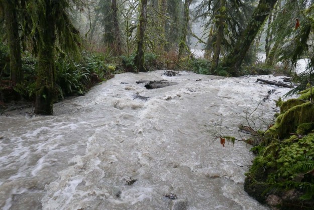
20151208BrawlingCreek

Brawling Creek just above the Middle Fork river

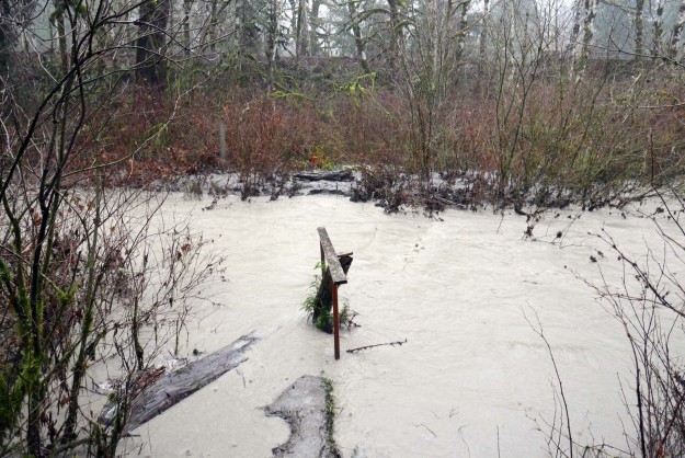
20151208SitkaSpruceCreek

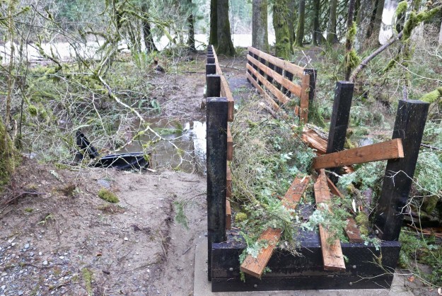
Sitka Spruce creek trail bridge was partially washed out and submerged under murky clay-filled water

20151209MailboxBlowdown

Trees down blocking the Mailbox trail parking lot

20151209MudFlowPattern

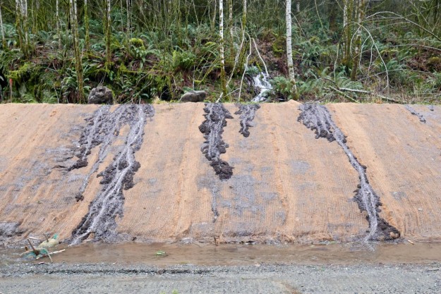
Small creek creates interesting mud flow patterns

20151209IslandDropBlowdown

Blowdown cleared by Island Drop

20151209MineCreekBridgeDamage

Mine Creek bridge damage

20151209MineCreekBlowdown

Blowdown by Mine Creek

20151209ChampionBeachRockButtress

Temporary rock buttress supporting Champion Beach road cut

20151209ChampionBeachOverview

Overview of area by Champion Beach that has been a concern for earth movements

20151209TopOfRockButtress

Area above temporary rock buttress that protects the road against minor mud and clay slumping

20151209RoadBlockedByTree

Big tree blocking road beyond Champion Beach

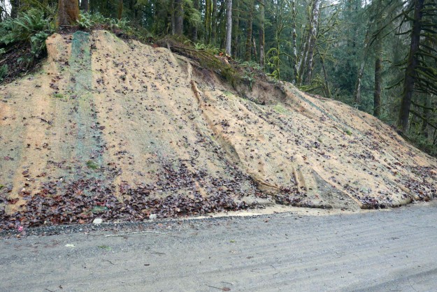
20151209SmallSlumpByRoad

Slumping road cut

20151216MiddleViewPulloutErosion

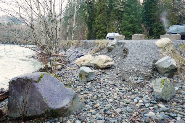
Partial washout of a dispersed camping site pullout. This pullout was built in 2014 as part of the paving project.

20151216SevereBankErosion

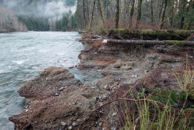
Severe bank erosion by a dispersed campsite downstream of Camp Brown. The river is aggressively migrating toward the road here with each major storm.

20151216TaylorSpurErosion1

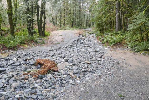
Further erosion of the Taylor River spur road. The river will likely flow here often now so it’s unlikely this will be repaired to a level suitable for motorized access.

20151216TaylorSpurErosion1

Further erosion of the Taylor River spur road. The washout is deeper than it appears in this photo.

20151211NewBlowdownOnDingordRoad

Fresh blowdown on the road to Dingford Creek from this storm. This was the major impact between the turnoff at the Taylor River and the Dingford Creek trailhead. Photo by Charles Lingel.

Before and after clearing debris from the road

Not all trees fall during the storm. The high water undercut the bank and the next big snow fall brought the tree down.

Not all trees fall during the storm. The high water undercut the bank and the next big snow fall brought the tree down.

Related News

MTSG dinner features Middle Fork appeal

The Mountain To Sound Greenway held it’s annual celebration dinner on December 2, 2015 at the Washington State Convention Center. As always they presented a series of accomplishments over the year, with the acquisition of land around Valley Camp being of interest here.
20151202ConventionCenter

Mountain To Sound Greenway Dinner & Celebration. Photo by MTSG via Twitter


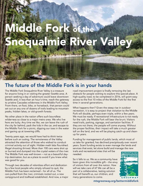
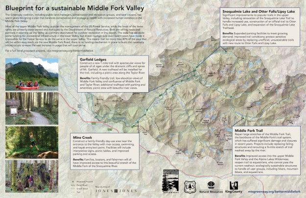
Besides that acknowledgement, each seat had a flyer on it with an appeal for contributions to support needed infrastruction in the Middle Fork valley. Pages from that flyer are reproduced here and it’s available as a PDF file from the MTSG website. If this is a cause you support, please consider donating to the MTSG which does an enormous amount of good work there.
2015MiddleFork101Handout1

Middle Fork 101 – Page 1

2015MiddleFork101Handout2

Middle Fork 101 – Page 2

2015MiddleFork101Handout3

Middle Fork 101 – Page 3


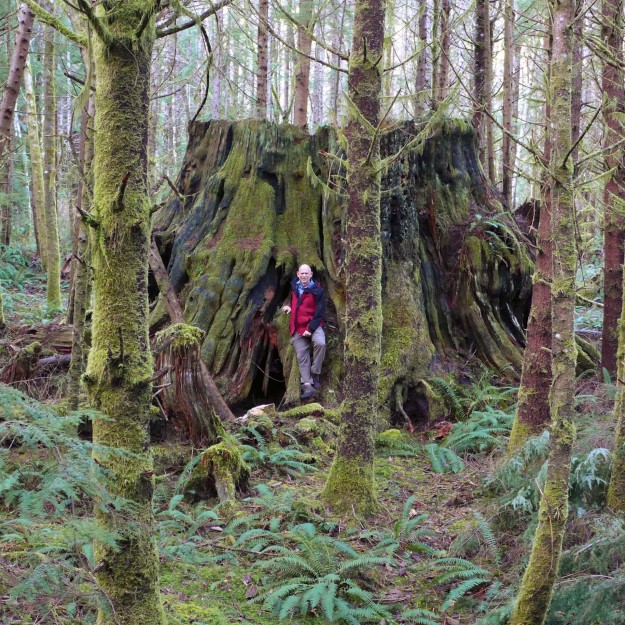
Of course, it was gratifying to see the use of two photos from this website’s author.
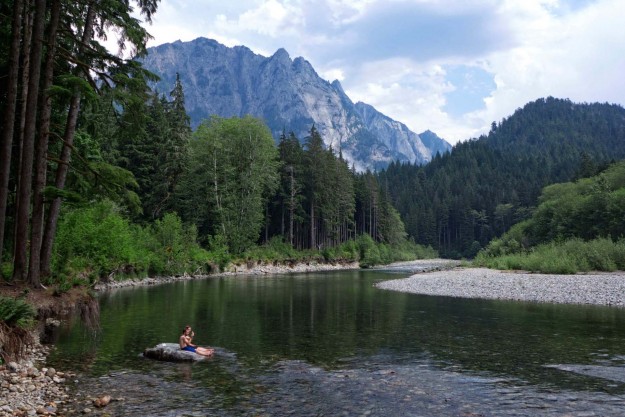
20140802MiddleForkSunbathers

Sunbathers on rock with Garfield Mountain in the background

20150113BigCCCStump

Possibly a stump from what may have been Washington’s biggest tree. 42.5′ circumference, 13.5′ diameter