A third 2015 storm caused high water flows on the Middle Fork river on November 17, the first time there have been three such significant events in a calendar year since records started in 1961. The peak flows rank this storm as the 10th highest to-date. The previous two events this year were the January 5 storm (8th highest) that closed the Middle Fork road for months, and the recent October 31 storm on Halloween that had somewhat lower flows and only caused a minor washout on the Taylor River road spur. The peak water flow of 27,300 cfs was just below the peak level of the January 5 event. Flow levels over 20,000 cfs were sustained for 10 hours.
On Thursday, two days after the storm passed, the WFLH announced that the road would be closed at least until Wednesday, November 25, 2015, an extension of 5 days from the previous closure. The closure point was moved to just beyond the Mailbox trailhead so it would be available for weekend. The concern for public safety is about some large boulders poised above the road at the new bank cut just before Champion Beach that could come down onto the road. Then on Wednesday, the closure was extended to noon Friday, December 4, including the Thanksgiving weekend. That date came and went with no opening and the most recent newsletter announced that the road will be closed indefinitely. The Mailbox trailhead will continue to be accessible.
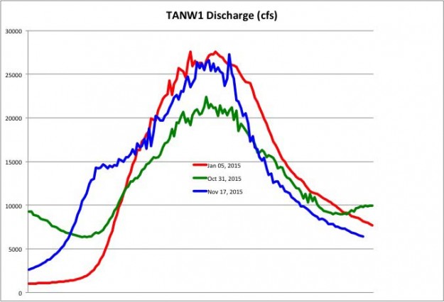
Comparison of three 2015 high water events
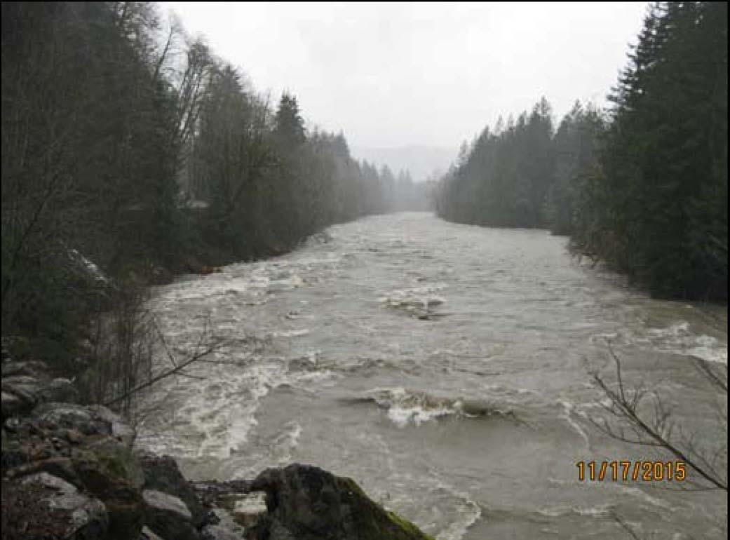
Middle Fork river at Island Drop on 11/17/2015. Photo by WFLH.
- The lower road below the Taylor River turnoff where paving construction has improved the culverts has not sustained significant damage and minor issues have been repaired
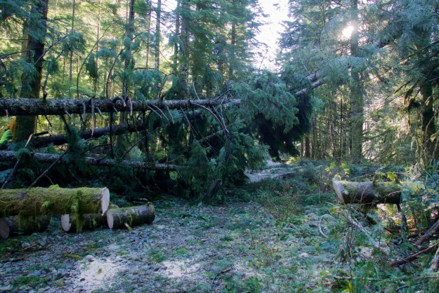
- A large number of trees blew down at MP 8.5. These were cleared by late Tuesday to help get some people out that were stuck behind them. The water was at least a foot deep over the road and running with a strong current when the river crested at ~9pm Tuesday.
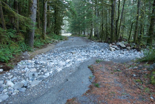
- At Champion Beach (~MP 4.5) mud and boulders are threatening to come down onto the road surface. The road closure has been extended to allow the contractor to stabilize this area.
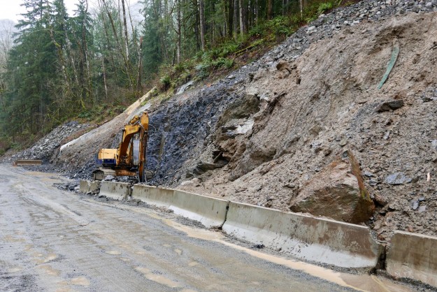
Stabilizing the road cut by Champion Beach
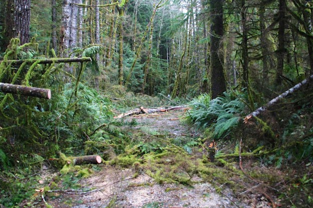
- Many trees were blown down between the Taylor “Y” and the Dingford Trailhead, some up to 3 feet in diameter. By Wednesday, November 18 these were cut out enough to let a vehicle pass although there are a few spots that require a high clearance vehicle and the road is in general rocky and full of potholes and downed limbs. Pickups and high clearance jeeps should not have trouble. A Subaru Forester made it through both with a lot of rock scraping underneath, especially at Oil Pan Creek.
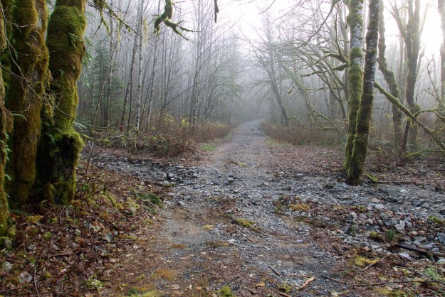
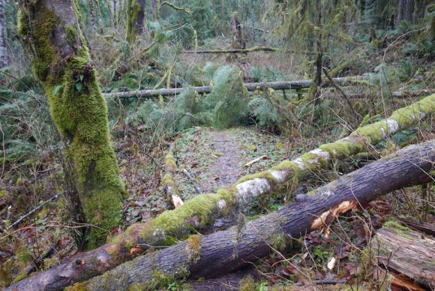
- MP 14.5 – A small creek by a multi-trunked alder is not too hard to cross.
Minor creek crossing by a multi-trunk alder
- MP 14.9 – The Garfield wash (aka Moore property) has a deeper gully on the near side. Pick your route carefully to minimize scraping.
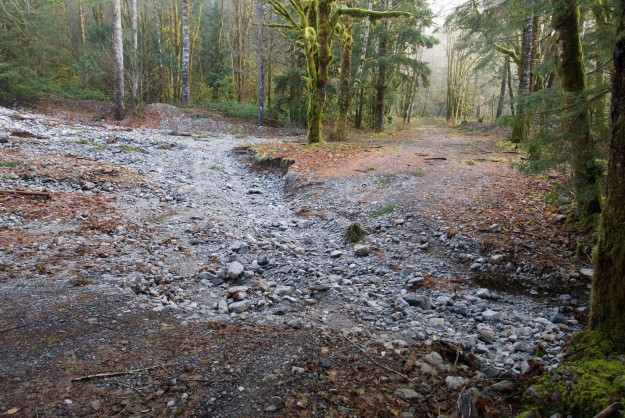
Garfield wash with a significantly deeper channel
- MP 15 – Oil Pan Creek is just beyond the Garfield wash and has a large new washout with steep banks up to two feet high. A ramp has been constructed on the right. This is the most difficult spot before reaching the Dingford trailhead.
Washout at Oil Pan Creek. Photo by Dick Craig.
- MP 14.5 – A small creek by a multi-trunked alder is not too hard to cross.
- The spur to the Taylor River trailhead is heavily eroded in three places and is not driveable even with high clearance vehicles. Park just beyond the bridge to hike in this area and walk the additional half mile to the trailhead.
A two foot deep channel has been scoured out of the Taylor River road just beyond the Dingford road turnoff

The Taylor River first crossed the road here during the 10/31 storm, but the more severe 11/17 storm deepened the channels significantly
- The Mailbox trail is a mess with lots of trees down. The old trail is blocked ~200 yards up from the kiosk. DNR is working in the Mailbox parking lot clearing trees that fell across the road.
- There is a large amount of blow down on the Granite Lakes trail. The lower part of the trail is bad enough, but still passable. However, beyond the bridge about 3.5 miles in it is nearly impenetrable; a group of very hardy trail runners were turned back on December 5.
Blowdown on the lower Granite Creek trail
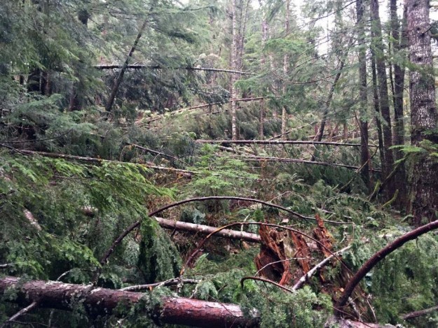
Massive blowdown on the Granite Creek trail beyond the bridge. “There are 100+ blowdowns in the 1/4-mile past the bridge and the 100 yards ahead we could see when we stopped appeared to be more of the same.” Photo by Kevin Smythe.
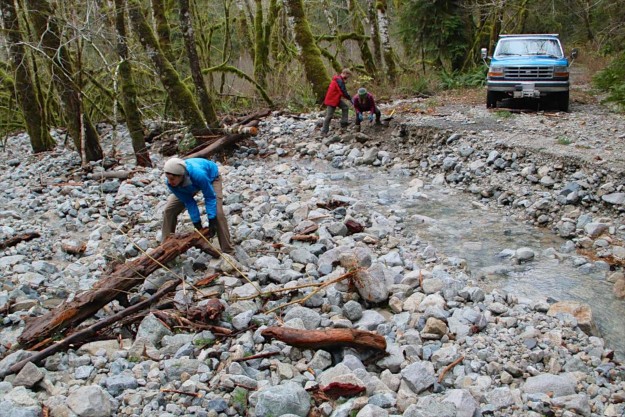
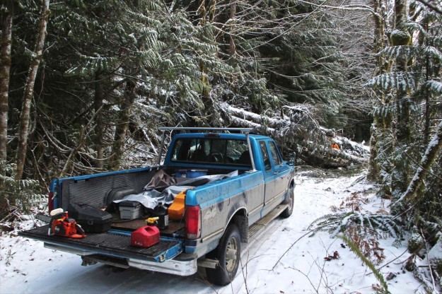
On November 18, the day after the storm, the first team of volunteers began the hard work of clearing the blowdown beyond the Dingford road turnoff as far as the Dingford Creek trailhead. Nearly 80 trees needed to be cut. The chainsaw work is hazardous on trees like this, many of which are under extreme stresses. Once the trees are on the ground and limbed, it is surprisingly hard work to toss all the limbs and debris off the road and roll or tip the sections of trunk far enough to be out of the way. Kudos to the many hours spent by these folks, which relieves the short-staffed Forest Service of having to schedule time for road work here.
Trees down at the bottom of the switchback on the road to Dingford Creek trailhead. Photo by Dick Craig.
Partially cleared blowdown on the road to the Dingford Creek trailhead. Photo by Dick Craig.
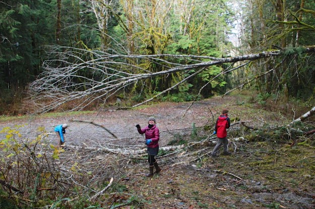
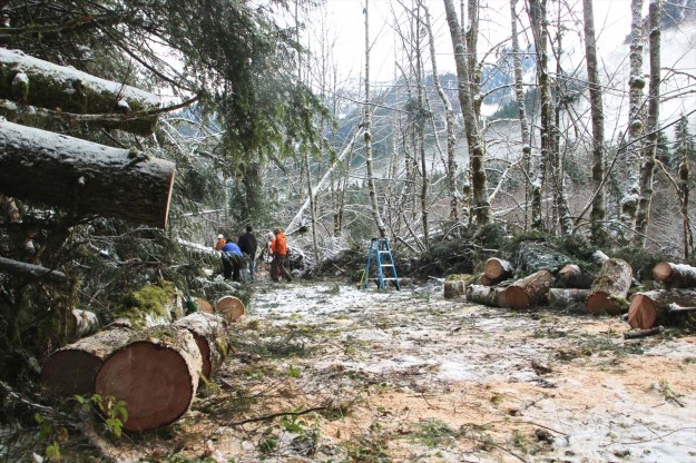
On November 25, a second team continued to clear the road beyond the Dingford gate.
Blowdown between Dingford Creek and Goldmyer
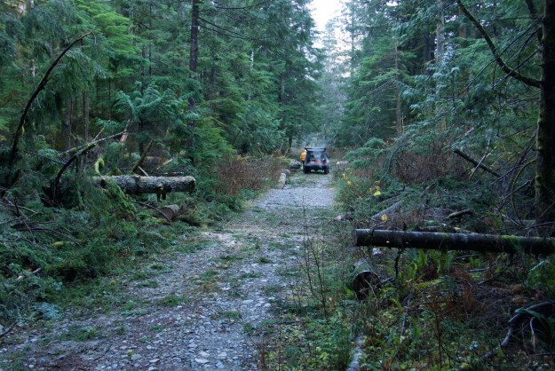
Successful clearing of several fallen trees
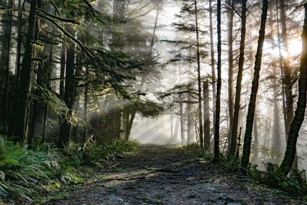
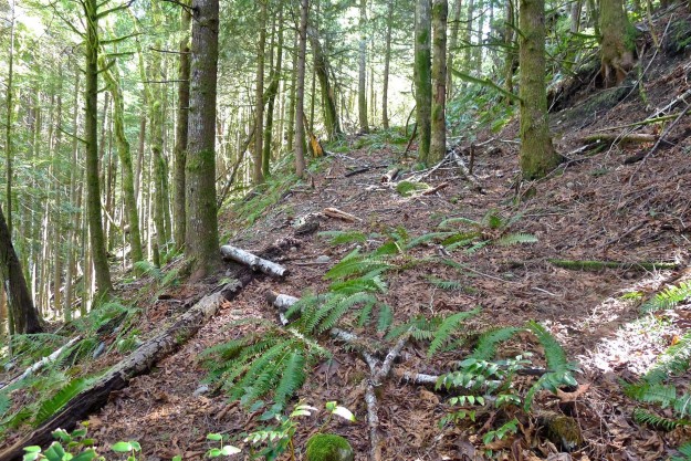
Clearing is not all hard work — it can be beautiful along the road as here a little before the Dingford trailhead with the sunlight streaming through mists.
On December 1, a third team of volunteers went in to clear an additional thirty trees on the gated road between Dingford and Goldmyer, now with a light covering of snow from recent cold and rainy days.
More clearing on December 1 near Goldmyer. Photo by Dick Craig.
Cleared cluster of downed trees. Photo by Dick Craig.
Downstream the combined flow of the three Snoqualmie River flows exceeded the Phase 4 flood level of 38,000 cfs.
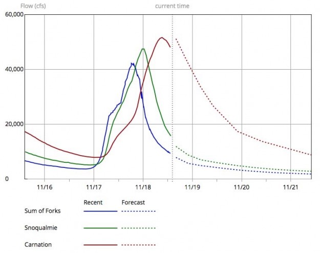
Combined Snoqualmie River flow crests
Related News
- 11/16/2015 Seattle Times – 65-mph wind gusts, falling trees, full rivers, mountain snow
- 11/17/2015 National Weather Service – Flood and Wind Warning “The storm currently impacting the western Washington is delivering heavy rain over the mountains with snow levels above 7000 feet. This will drive the area rivers like the Elwha and Snoqualmie Rivers above flood stage.” and “Wind … south or southwest 25 to 40 mph with gusts near 60 mph are expected.”
- 11/18/2015 Seattle Times – 2 killed, thousands without power as winds hit Washington state
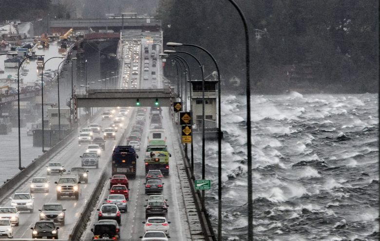
Wind travels across Lake Washington, buffeting the 520 floating bridge as the storm grows in strength. (Steve Ringman / The Seattle Times)
- 11/19/2015 Save Snoqualmie Falls – A beautiful close up video of the falls at high water, although not at the peak flow of this event.