Monthly Archives: October 2015

Halloween High Water

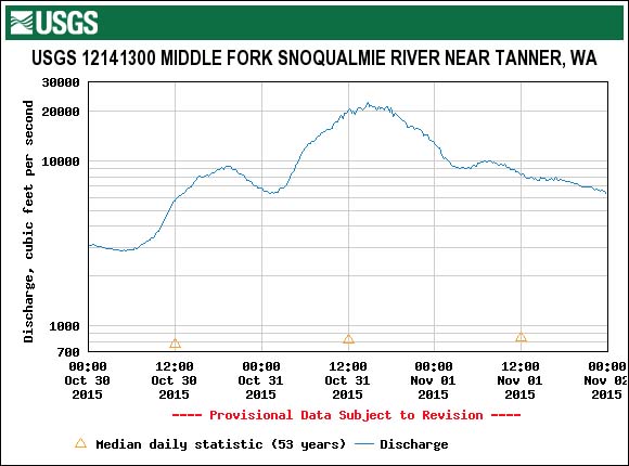
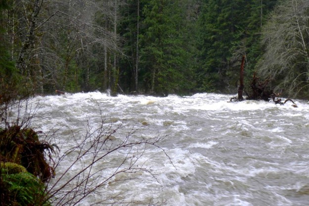
A heavy rain storm on Halloween weekend that dropped 4 1/4 inches of rain over 2 days resulted in a peak flow of 22,400 cfps on the Middle Fork river. The rain was steady without a heavy downpour at any one time and there was no snow to melt in the mountains, factors which helped avoid major damage to the road. But flows of ~20,000 cfps were sustained for 5 hours. The Taylor river was especially wild — a log jam formed just above the turn off to Dingford Creek and caused part of the river to flow over the spur to the Taylor River trailhead. Later reports indicate that SUV style vehicles should still be able to negotiate the trench eroded across the road (see the last photo below).
20151031TANW1Graph


20151031HalloweenHighWater03

The Taylor River overflowed it’s banks and ran across the spur road to the trailhead in two places.

20151031HalloweenHighWater02

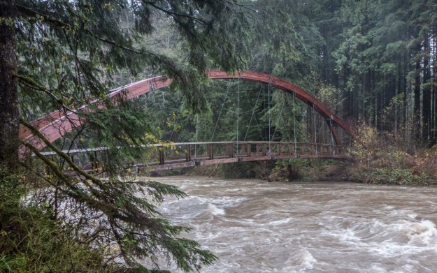
Gateway Bridge still safely above the water

20151031HalloweenHighWater04

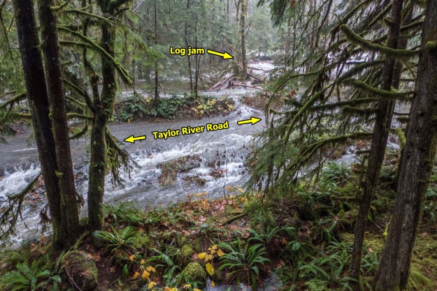
The log jam at the top of the picture restricted the flow of the Taylor River causing water to flow across the road

20151031HalloweenHighWater05

The log jam is at the left of this picture in front of the tree island. The tree with the huge root ball on the right came down the river while I was standing here.

20151031HalloweenHighWater06

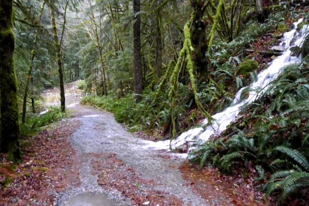
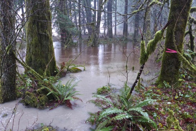
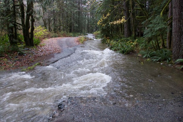
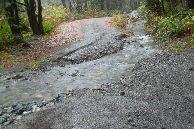
A creek flowing down an unusual spot along the road to the Dingford Creek trailhead. Normally this water would come down the drainage in the background.

20151031HalloweenHighWater07

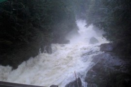
Dingford Creek falls from the bridge. The spray was so intense it was impossible to get a clear shot.

20151031HalloweenHighWater08

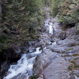
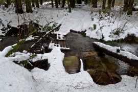
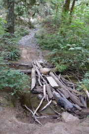
Compare to flow level in late summer

20151101HalloweenHighWater09

Taylor River trailhead washout on November 1 after the high water receded. Photo by Bill Davis.

Related stories

  • Cliff Mass Weather Blog – Serious Precipitation and Flooding is Probable During the Next 72 Hours
  • Living Snoqualmie – Heavy Rain, Wind Roll into Snoqualmie Valley; River Rising, Flood Warning, Wind Advisory Issued
  • SnoValley Star – County issues Phase III flood alert for Snoqualmie River

Mine Creek bridge improves river access

This week the DNR installed a new bridge over Mine Creek at the Island Drop* kayak launch. This is part of the implementation of the Snoqualmie Corridor Recreation Plan approved in March 2015.

December 9, 2015 update: The railing on the new bridge was damaged by a tree falling across it during an early December storm.

20151114NewMineCreekBridge1

New Mine Creek bridge

20151114NewMineCreekBridge2

New Mine Creek bridge. Kayakers in background are preparing to put in.

20150224MineCreekBridgePlan

Project description on other side: To construct a trail bridge across Mine Creek to access a kayak put-in spot in an eddy on the Middle Fork Snoqualmie River


While the creek is not large and most of the year it’s easy to simply step across it, especially by kayakers prepared to be fully immersed in the river, it regularly accumulated a haphazard assembly of logs and other debris to make the crossing easier. That should not be a problem now except when the river is at flood stage and the whole Mine Creek area is under water (see Jan 2015) photo below.
20111209MineCreekCrossing

Mine Creek crossing, Feb 2011

20120121MineCreekCrossing

Mine Creek crossing, Jan 2012

20140122MineCreekCrossing

Mine Creek crossing, Jan 2014

20141125MineCreekCrossing

Mine Creek crossing, Nov 2014

20150105MineCreekCrossing

Mine Creek crossing, Jan 2015 flood

20150525MineCreekCrossing

Mine Creek crossing, May 2015

20150808MineCreekCrossing

Mine Creek crossing, Aug 2015


Reference: Snoqualmie Corridor Recreation Plan PDF document

* The name Island Drop was originated by kayakers before 2006 when there was an island in the river just above the bend by the road. It was completely washed away in the November 2006 flood. Perhaps a better name is appropriate 10 years later.