Monthly Archives: January 2014

Skier injured in fall by Snow Lake

20140125CliffAndBelow

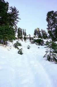
Cliff and slope where skier fell

A backcountry skier in the vicinity of Snow Lake divide was badly injured when he slid hundreds of feet down the north side of the ridge towards the south end of Snow Lake, coming to rest in the trees about 100 feet above the lake. According to his skiing partner JPH at nwhikers.net, “he’s pretty banged up, but in the end it was a broken arm, stitches in the face and lots of big bruises – definitely not as bad as originally anticipated.” A more detailed account is in a post on Turns All Year. Fortunately he was wearing a helmet or this could have turned out much worse. A nearby party of three at Snow Lake saw the accident and came over to help, speeding the call to SAR and avoiding leaving the injured skier alone. King County’s Guardian 2 search and rescue crews hoisted the injured man to safety and transported him to Harborview Medical Center in Seattle. Seattle Mountain Rescue also participated in the rescue.


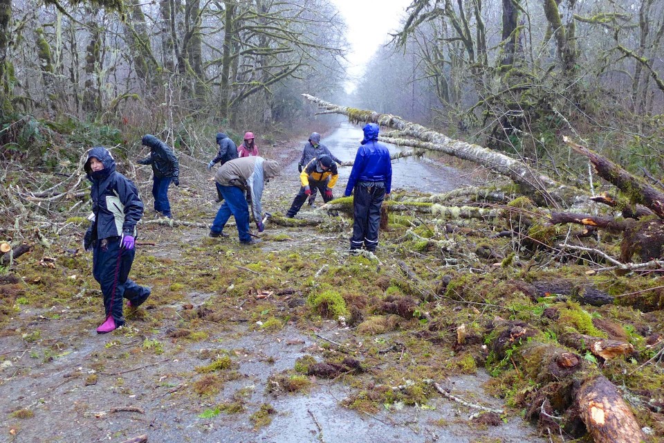
Hikers, climbers and skiers in the Snoqualmie Pass area reported the development of a hard icy crust at relatively low elevations. On anything except nearly level ground crampons were necessary for safe travel. The Northwest Avalanche Center issued an unusual non-avalanche hazard alert 3 days before this incident. The party was aware of these conditions and had all the necessary gear along. It underscores how unusual these conditions were where what would normally be a minor slip turned into an uncontrolled fall.

January 22, 2014
NWAC
On 13 January a heavy local freezing rain event occurred in the Snoqualmie Pass area above about 4500 feet, covering the surface with about a 2-3 inch ice crust. This crust should break down over time but a fall on a slope on this surface could result in a long and dangerous ride!

20140125LowMountain

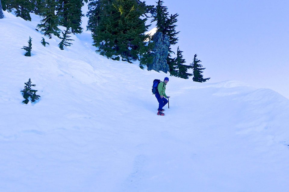
A climber on nearby Low Mountain the same day descends crusty ice using crampons and an ice axe


Related coverage

  • 2014/01/18 Snoqualmie Pass area ice crust alert
  • 2014/01/25 Skier injured after fall from cliff at Snow Lake
  • 2014/01/26 Saturday heli-evac from Snow Lake
  • 2014/01/26 Back Country Skier Falls off 400 Foot Ice Cliff Near Snow Lake
  • 2014/01/27 Mountains Prove Treacherous over Weekend: Snoqualmie Woman Dies, Two Men Injured
  • 2014/02/01 SMR – February 2014 newsletter with an account of this incident

Painted Sign

Graffiti is not uncommon along the Middle Fork road, but it’s rare that it’s done so elaborately and results in such a cryptic message. Between the USFS and others, defacement of signs, bridges, trees, rocks and other objects doesn’t remain in place for long. That’s a good thing because graffiti contributes to a perception of disorder and permissiveness, and that can be reversed by timely removal.

20140112PaintedSign04

Around New Years day of 2014 vandals removed the sign board, spray painted the frame in two shades of blue and painted the enigmatic word “Tree” along with an arrow pointing to the right.

20140115PaintedSign05

Within two weeks of being vandalized, the graffiti has an obscuring layer of paint


This particular sign board has been in place since 2011, featuring several different messages all related to fire prevention.
20111023PaintedSign01

Before the fall of 2011, this location had a simple “No Target Shooting” sign. The new sign allows for a changing message, in this case “A Beautiful Forest Is A Matchless Sight”

20120906PaintedSign02

A year after this sign board was erected it got a new message — “Wanted, Your Campfire DEAD-OUT”

20130330PaintedSign03

The third message on this board appeared in the spring of 2013 — “Protect And Enjoy Your National Forest”

January Storm Damage

Living Snoqualmie called it a one-two punch from Mother Nature. A warm front brought heavy rains and high winds to western Washington on January 11 and a flood watch was posted. But there has not been enough low elevation snow so far this winter to produce dangerously high volumes on the Middle Fork river and the flow peaked at a safe 7.76 feet/6,560 cfps at 1am on January 13. Fortunately there was no significant damage to the road surface. As expected, trees were downed, but all of them were already passable by mid-morning on January 12.

20140112StormDamage01

Double whammy on the straights before the concrete bridge with a young douglas fir from the right and an alder from the left.

20140112StormDamage02

Trees rarely fall alone, and one medium size alder brought down a smattering of smaller ones with it.

20140112StormDamage03

Puddles of water colored with valley bottom clays fill up near Big Blowout Creek bridge

20140115StormDamage04

Alders are the first trees to grow back after logging and weaken when deprived of light by maturing firs and cedars. This spindly alder was growing behind a large douglas fir stump. Expect the white-barked alders in the center to fall in coming years as well.

20140112StormDamage05

Not all trees fall during the storm. This section of road was clear in the morning after the storm, then a large maple uprooted mid-day and brought down an alder with it. A spontaneous crew of hatchet-wielding visitors blocked by the fallen tree cleared a path wide enough to get vehicles past.


20140112StormDamage06

A jumble of fallen trees triggered by a large uprooted maple, neatly slicing another tree in half on it’s way down.


20140115StormDamage07

Three days later a volunteer chain saw crew has cut back the larger branches. Much of the large debris will probably be salvaged for firewood.