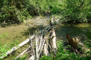
Precarious crossing to Pratt River bar trail
The Forest Service has proposed improved access to the Pratt river bar, including a new bridge across a creek and a toilet. Currently the trail to the river bar requires negotiating a few carefully balanced steps on logs spanning a small creek, then deciding which of several gravelly paths to follow to reach the river.
In their words this project will “provide safe access to the Pratt Bar, by converting 1,100 ft. of closed non-system road to a USFS system trail. A 35-40 foot bridge would be constructed over a creek and a toilet and trailhead sign would be installed in the existing parking lot.” The comment period ends in March, 2013. Funding for this work is pending approval of a package of enhancements associated with the FHWA paving project.
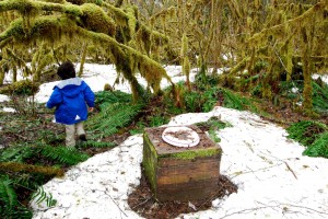
photo by Mark Griffith
New toilet facilities along the Middle Fork road are always welcome. This old model near the bar follows the privacy-by-obscurity model — good luck finding it!
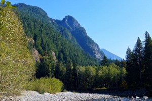
Pratt Valley view from the bar
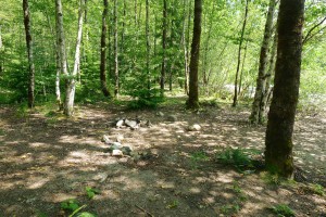
Dispersed campsite by the river bar
Based on the number of fire pits, this is a popular area for dispersed camping and for good reason — the views on both sides of the river are outstanding. During low water periods, it’s also a short-cut to the Pratt River valley if you’re willing to ford the river.
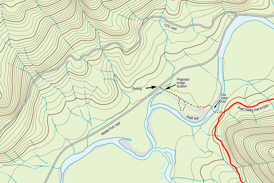
Pratt River bar trail proposal map
Note: The Google satellite imagery has an offset error for most of the Pratt River valley and some outside of it. That’s why the annotations on this map are off. The line for the road and other items are correct, the satellite imagery is shifted north.
View Pratt River Bar trail in a larger map
![]()
PDF archive of the Forest Service proposal